After hearing the news of Tioga Pass finally opening, we were itching for a quick mini-road trip thru the Sierra, but the thought of crowds made us pull out the atlas in search of an alternative route. And this quick one-nighter loop did not disappoint.
It’s July, and after a record-breaking winter, we hoped to find high Sierra snowpack, raging rivers, and dramatic waterfalls without waiting in long lines. We packed the cooler, bikes, and dog in the back of the truck and set off toward Sonora Pass for a quick one-nighter mini trip.
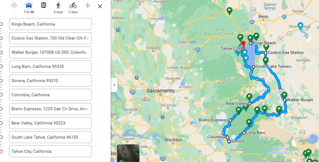
After topping off at Costco in Carson City, we drove south on Hwy 395 to Sonora Junction. We were delighted to see the vibrant shades of green grasses and the Walker River still ragging thru the canyon. This time, we chose to pass Walker Burger but highly recommend the peanut butter milkshake, especially on a hot summer day.
From Carson City, head south on Hwy 395 to Sonora Junction.
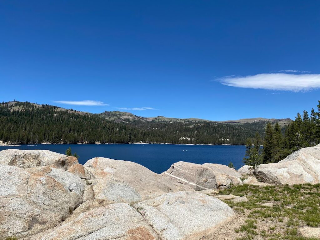
The climb up Hwy 108 thru the lush green meadow, past the military winter training facility and horse camp, was steep and spectacular. Snowfields melting out, adding to the water show as we climbed further up to and through the granite boiler fields. We drove on with windows down, enjoying the cool air of 9,000 feet.
We camped on National Forest (brown sign) land near Long Barn that night. We fell asleep listening to the odd and distant chorus of what sounded like cowbells. On our way back to the highway to next morning, we confirmed that the bizarre sound was, in fact, cows wearing bells!
Rounding out our loop to connect with Hwy 4, we cut through Columbia via Parrots Ferry road, hoping to find coffee and breakfast. Gaining elevation again, escaping the already warm 2,000 feet foothills, we opted for Bistro Expresso and Cafe in Arnold. Bacon croissant sando, a side of breakfast potatoes, and delicious frappuccino were good fuel for the type 2 fun bike ride I had planned for us in Bear Valley.
From Hwy 108, we cut through Columbia via Parrots Ferry road to Hwy 4 towards Bear Valley and Ebbetts Pass
Bear Valley is a hidden gem—a quiet and quaint ski resort along Hwy 4. There was a music festival that provided a triumphant instrumental finish to our grueling bike ride around Lake Alpine. I was banned from Bike route planning for two weeks after this ride. If you enjoy cross-country rides, multiple creek crossings, mosquitoes, and hiking your bike thru granite boulder fields, 1,200 feet gain, 10-mile loop, click here. However, you’ll have the entire trail to yourself.
After our near-death ride and a sponge bath on the side of the road, we hit the home stretch. Hwy 4 twists and turns back into the heart of the Sierra thru Ebbetts Pass. Once again, overlooking exposed fields of granite and green valleys far below. The road narrowed to less than two lanes and no dividing lines for an extensive section. Blind corners lead into hairpin turns, later learning Ebbets Pass is one of the least traveled highways thru the Sierra.
Hwy 4 meets Hwy 89; we made our way around the west shore
Returning to more familiar territory where Hwy 4 meets Hwy 89, we went home via the lake’s west shore. It was the perfect one-night getaway, high altitude, fresh air, and snow. No crowds, just cows wearing cowbells.
More Tips
- Download Google Maps to use offline, cuz you can still find areas of no cell phone service in California, believe it or not. Keep a paper map tucked between the car seat.
- Drive this route in reverse.
- Camp at higher elevations for cool, comfortable sleeping weather.


We saw more cows than people. This drive was exactly how we wanted to spend a couple of days in the mountains away from the summer crowds. Please drive safe; these roads are anything but straight and steep. Roll down the windows and enjoy the ride.


